 Search


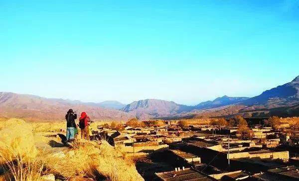
- Today’s Octagon City, the administrative level is a village, where the Han and Tibetan people live here
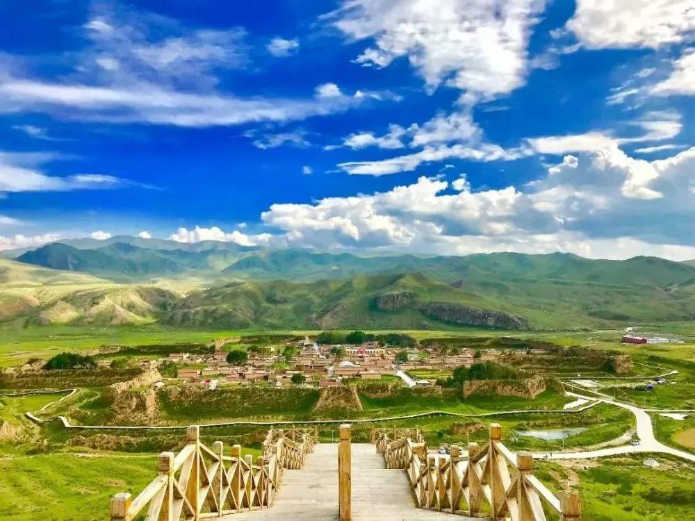
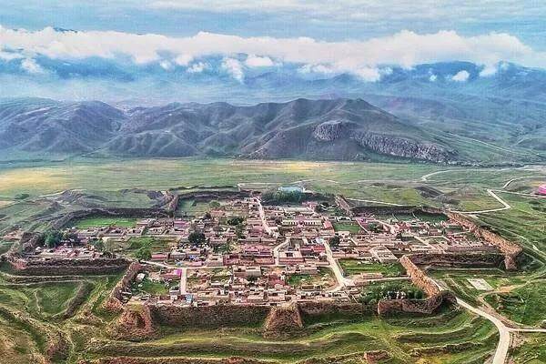
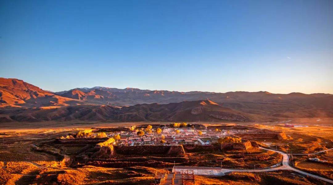
The octagonal city of Ganga, due to its peculiar architectural pattern, is still relatively intact after thousands of years. Its key geographical location and long history give it a strong and mysterious color, attracting many scholars and enthusiasts to find out. The octagonal city is called "Kalang" in Tibetan and "Yongzhong Kar" in Tibetan history. Because it looks like the Buddhist symbol "卍" ("卍" is called Yongzhong in Tibetan, meaning eternal), it is actually a hollow " In the shape of a cross, there are eight piers on each corner of the city to form an octagon, hence the name. The Octagon City is located on the platform where the Yangqu River and the Yangla River intersect in the eastern part of Gangatan, Xiahe County, Gansu Province. It was an important military base with strong defenses in ancient times.
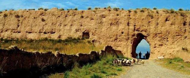
The ancient city covers an area of 200,000 square meters, with a perimeter of 2,193 meters and a wall height of 10 meters. There is an S-shaped passage in the east and west urn city, and there is a moat outside the city. The north city is surrounded by mountains and has no gate. An outer wall is built from the west city through the south gate to the east city, and an outer city is built outside the south gate. In the design of the castle, it breaks through the square and rectangular frame of the past and forms a system of its own. The inner and outer walls, water diversion and moat, vertical and horizontal trenches, and octagonal echoes.
The architectural form of the octagonal city is the traditional architectural form of ancient Chinese castles. The city is dug outside, the castle is built in, and the city is protected by water. The city wall adopts the method of rammed layer clamp rods, the clamp rods are uniform in thickness and arranged in an orderly manner. The rammed layer at the lower part of the city wall is thick, and the sand and gravel between the rammed soil layers are accompanied by branches. From the architectural design point of view, the city wall has many curves and edges and corners, and the overall shape is "swastika". Each corner is within the range of a crossbow, which is easy to defend and difficult to attack. The relatively intact octagonal city provides high artistic and scientific value for studying the history of ancient Chinese cities and ancient buildings.
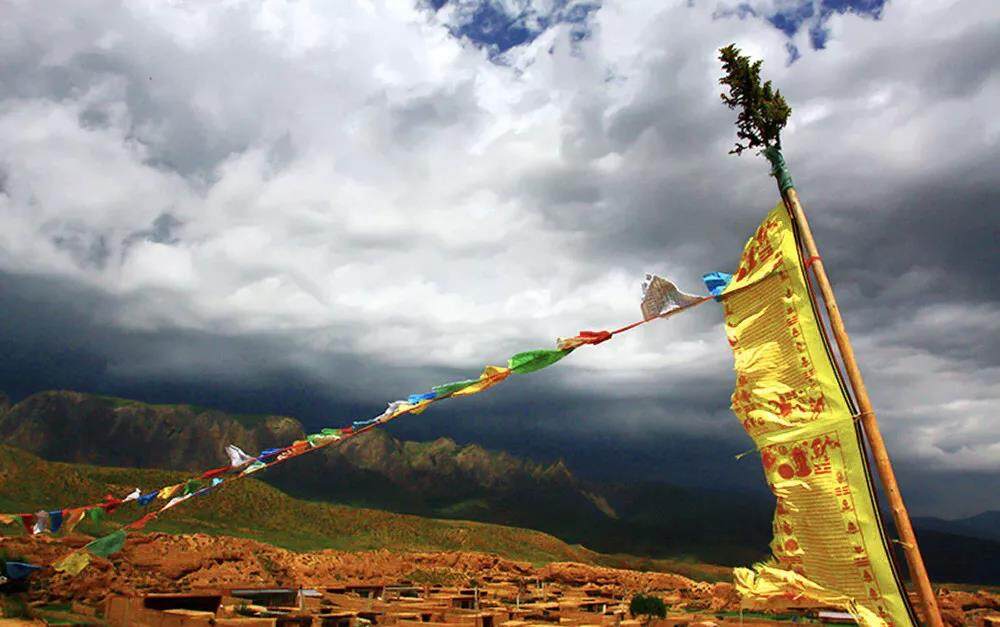
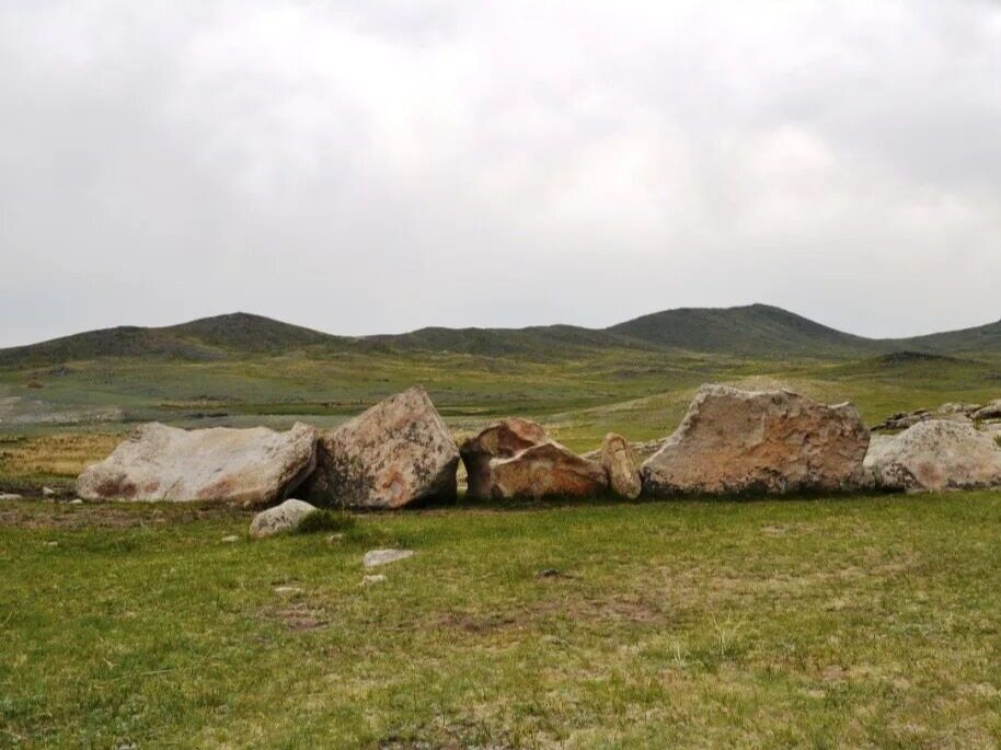
The ancient city is located on the northeastern edge of the Qinghai-Tibet Plateau, with an altitude of 3000-3800 meters. It has a cold and humid climate. The plateau has obvious continental climate characteristics. The average annual rainfall is 516 mm and the annual sunshine time is 2,296 hours. The Octagonal City is part of the Ganga Secret Realm. The Ganga Secret Realm is centered on Ganga Town, Xiahe County, southwestern Gansu, with the octagonal ancient city, the ancient Bon temple Zuohai Temple, the Baishiya Temple, and Dalijia Mountain as the core, forming the cliff wall , Grasslands, plateau lakes, ancient cities, ancient temples, stone forests, canyons, prehistoric caves are a unique area. Here is a typical plateau grassland, an ideal natural pasture, surrounded by mountains. Every summer, the entire grassland is green and full of flowers, and the Yangqu River and Yangla River meander and flow. On the flat land, hills and terraces around the ancient city, there are traces of ancient abandoned terraced fields.
The age of the octagonal city has always been controversial. There are currently four sayings: "Baishi County was set up in the Han Dynasty", "the city was built in Xixia", "Xin Si La and Xi Xia were built together", and "Qing Tang Jian Si was built by the regime alone." There is still no conclusion.
The octagonal city has a dangerous terrain. It is the throat fortress of "Going east to Guanzhong, west to Weizang, south to Chuankang, and north to Qinghai". The customs and cultures of various ethnic groups collide and merge here. At the same time, it was also a military fortress fiercely fought by the central government of the past dynasties with the Tuyuhun, Tubo, Xixia, and Xunsuo dynasties. It was washed by thousands of years of wind, frost, rain and snow, and passed through the Tang, Song, Yuan, Ming and Qing Dynasties.
Volume 28 of the Book of Han records: “Jincheng County has 13 counties under its jurisdiction, including Baishi County, and Lishui out of Xisai, east to Paohan into the river.” This is the octagonal city of “Baishi County in Han Dynasty”. One of the basis of the origin theory. However, no matter which dynasty was founded, the key location of the Octagonal City was the main transportation route on the southern line of the ancient Silk Road, and became the local power of Tubo to "unify the Song Dynasty against the Xia", communicate with the Han-Tibet business road and cut off Hexi in Xixia. The fortified place on the south line after the middle line of the Silk Road in the corridor.
In the Tang Dynasty, the octagonal city was called "Diao Nest City" and "Yegong City". Song Chongning changed its name to Xunhua City in the second year. It is an important military installation on the ancient Tangbo road, and an important facility for the Central Dynasty to protect the smooth flow of the southern Silk Road and ensure the safety of postal stations. The Tang-Pan Ancient Road in Gansu Province crosses the mountain between Shaanxi and Gansu provinces—Longshan Mountain to reach Qinzhou. It goes back to the Wei River and continues westward over Niaoshu Mountain to Linzhou. From Lintao northwest, crossing the Yellow River through Hezhou into Qinghai, and then northwest through Longzhicheng to Shanzhou, the eastern section of the ancient road can be called the eastern section of the Tang Dynasty. This is the traditional route from the Central Plains to the Hehuang area since the Han Dynasty. A large number of architectural components and cultural relics from the Tang and Song periods were unearthed in the city.
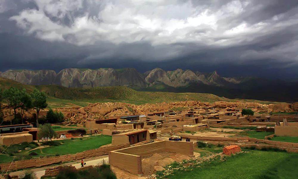
In the Yuan and Ming dynasties, the Octagonal City was abandoned and only used as an important post. In the early Qing Dynasty, it was planned to open up farmland here, but it was not implemented due to poor natural conditions. The name "octagonal city" appeared in historical records during the Qianlong period. People gradually moved to live in the octagonal city during the Republic of China, and now a village of more than 100 households inhabited by Tibetans and Han ethnic groups has been formed.
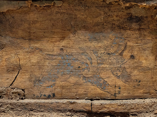
According to the investigation and survey by archaeological experts, the Octagonal City has an urban construction system within 0.5 square kilometers, which is a typical city in ancient Chinese society. Broken pottery pieces from the Neolithic Age, pottery pieces from the Tang and Song dynasties, Han tombs in the northwest highland outside the city, and currency from the Wang Mang era were unearthed here. The confusing history and self-contained architectural features make Octagon City an extremely important and precious ancient city. Editor/He Yuting
Comment


 Praise
 Collect
 Comment

 Share
Share


Write something~