 Search


- As of the end of April, 710 kilometers have been completed, and the battle against desertification by road has been fully accelerated
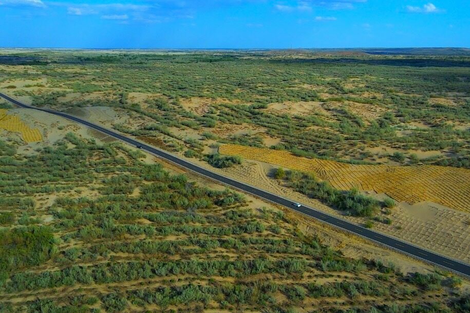
In 2026, Inner Mongolia plans to construct 2600 kilometers of sand crossing roads. As of the end of April, 41 projects have started construction, with a completed scale of 710 kilometers, accounting for about 27% of the annual task. From Maowusu to Keerqin, a comprehensive battle to control desertification by road is unfolding.
Connect the happiness line of herdsmen
In early summer, the Maowusu sandy land is hit by hot winds, and lemon shoots and sand willows stubbornly grow in the wind. At the construction site of the S215 line of Tongshe Highway in Wushen Banner, Ordos, mechanical shuttle and sprinkler coordination have been used to extend the embryonic highway across the sandy sea into the distance.
In 2026, Wushen Banner plans to implement 5 road desertification control projects, with a total length of 51.5 kilometers and a total investment of 69.28 million yuan. The project leader Hastoya said that in the past, the desert hinterland was mostly natural roads, and merchants were unwilling to go deep. After the road was built, it connected grassland pastures and opened up transportation routes for agricultural and animal husbandry products.
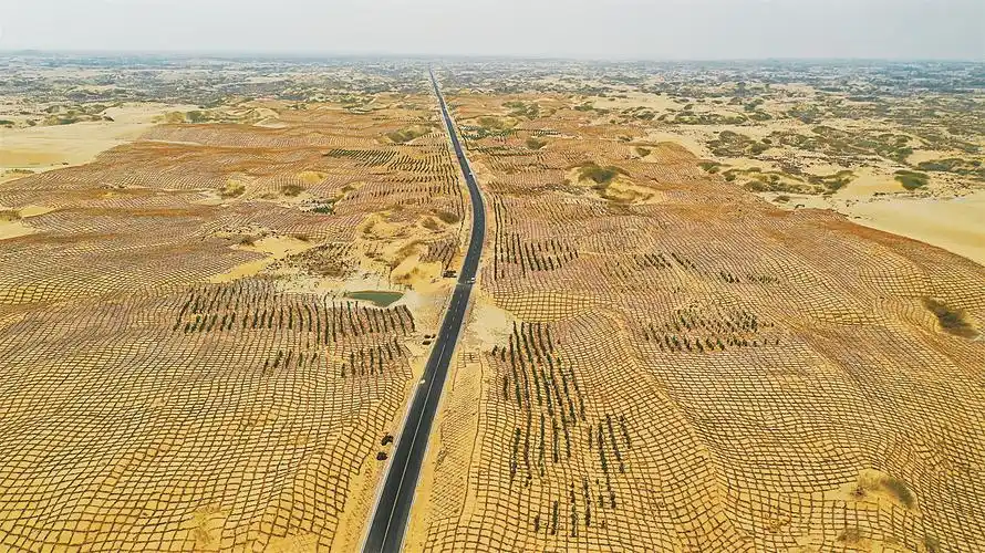
The total length of Gaogutai Dahan Highway in Tongliao Kezuohou Banner is 27.316km, which is reconstructed and expanded according to the standard of third-class highway. Maodao Tusumu passing by is the last one in the whole Banner that has not been connected to Class III highway or above. This road is the lifeline for the people in the sand area to connect with the outside world.
From entering the sand, people retreat; to entering the road, sand retreats
Ordos is a pioneer in the road based desertification control model. The first Xiwu sand crossing highway started construction in Hangjin Banner in 1997. Over the past 30 years, a governance model has been formed based on road zoning, block management, locking in the surrounding areas, and penetrating the hinterland. The experience of Hangjin Banner has been included as a typical case in the United Nations Convention to Combat Desertification.
Comprehensive layout of the three major war zones
Inner Mongolia has four major deserts and four major sandy areas distributed from west to east, undertaking 60% of the national Three North Project tasks. In July 2024, the plan for the annihilation of the Khorchin and Hunshandake sandy areas was issued, covering 39 banner counties and districts in 5 league cities; In June 2025, the plan for tackling the Yellow River bend will be implemented, involving 36 banners, counties, and districts in 7 leagues and cities. Two major plans are overlapping, and the sand crossing highway is being upgraded from a local exploration to a systematic project. Keywords: sand control through roads, sand crossing highways
The 2600 kilometer sand crossing highway is not only a transportation line, but also an ecological and livelihood line. Inner Mongolia is using roads as a pen to write a new chapter of green advance and sand retreat in the deserts of northern Xinjiang.Editor/Cheng Liting
Comment


 Praise
 Collect
 Comment

 Share
Share


Write something~