 Search


- Implementation path for Nepal to transition from a landlocked country to a landlocked country
- The economy along the route and cross Himalayan connectivity will also usher in a new pivot
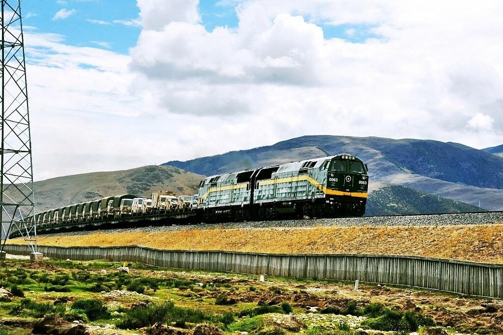
Traveling north from Kathmandu, the winding mountain road takes about half a day to reach the Jilong River Valley. Tang Dynasty envoy Wang Xuance traveled to India through here, and the inscriptions on the cliffs are still recognizable today; After the 2015 earthquake, Zhangmu Port was closed, and Jilong took over as the main force for land transportation between China and Nepal. In late October, Chinese personnel unfolded the drawings to the Nepalese delegation in Xi'an, and after 42 months of preliminary feasibility study, the outline of the train passing through the mountains was clearly drawn for the first time.
Survey in the valley
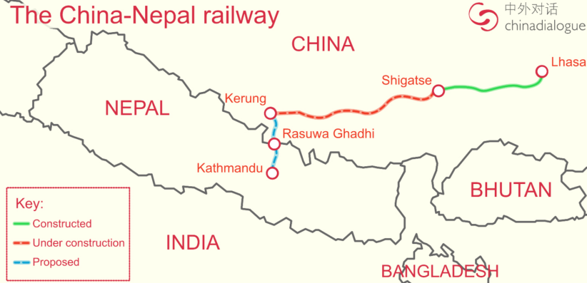
The line enters from Jilong, Xizang, passes through Resova and Nuwakot, and ends at Toka, Kathmandu. There are four stations in Jilong, Dunche, Nuwakot and Toka. The Nepalese section is about 78 kilometers long, with an altitude decreasing from about 2774 meters to about 1400 meters, a drop of over 1300 meters, and nearly 96% of it being bridges and tunnels; The long tunnels, high bridges, and complex geological routes require extremely high requirements for survey, construction, and operation, and Chinese enterprises with experience in high-altitude mountainous railways have obvious advantages. In October 2019, the China Nepal Joint Statement clearly stated the launch of feasibility studies, funded by China, and included the construction of a cross Himalayan three-dimensional connectivity network to help Nepal get rid of its status as a least developed country as soon as possible and become a middle-income country by 2030. The Chinese section has been connected from Lhasa to Shigatse, extending towards Jilong and reserving conditions for a southern connection.
Cost and Investment
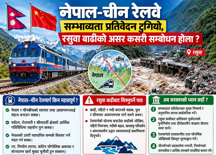
The difficulty is not only in the mountains. The initial estimate for the cost of the Nepal section exceeded 400 billion Nepalese rupees (approximately 17.7 billion RMB), and the 2018 pre feasibility study estimated it to be 257 billion Nepalese rupees (approximately 11.4 billion RMB). At that time, the route was 72.25 kilometers long, with a single kilometer of approximately 3.55 billion Nepalese rupees (approximately 158 million RMB), an increase of over 50% in new numbers, and is awaiting detailed project report approval. The funding criteria vary: Nepal hopes to provide free assistance instead of loans, stating that the scale exceeds its capacity and concerns debt risks; The Chinese side suggests accepting the loan and hopes that the Nepalese side will make substantial contributions. The feasibility study is supported by China's free aid funds, and the construction funding model is yet to be determined. The sustainability of financing and debt needs to be evaluated. Nepal has requested China's support for the preparation of the report.
Floods and transportation volume
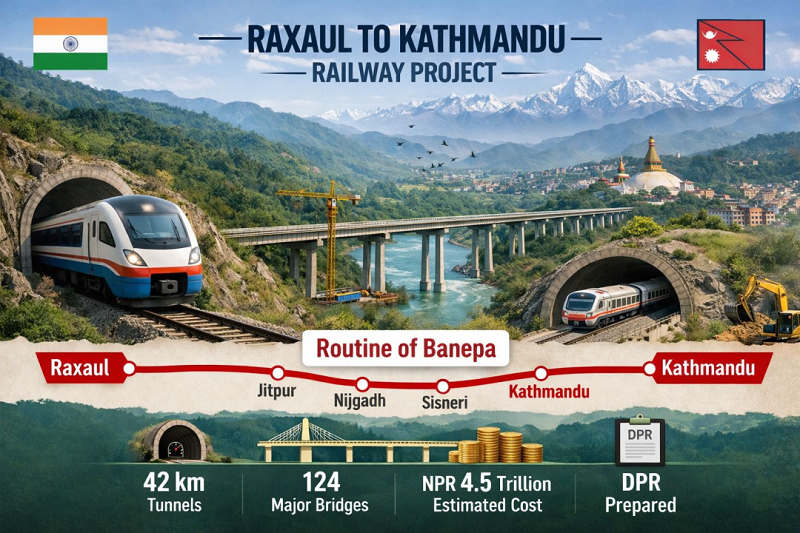
The completion of the feasibility study coincided with the flood at the Zesawagadi Port in August 2026, which caused severe damage to roads, bridges, electricity, and customs facilities. Disaster resistant design became a key focus of the demonstration. Chinese experts have reviewed the direction after the disaster, avoiding flood prone areas with elevated bridges and tunnels, and setting higher defense standards than this flood; There are still voices in Nepal advocating for a re evaluation of the near Jilong and Rexogadi sections based on the changed terrain. The Railway Commission stated that the detailed project report will address technical issues related to flood control, develop safety measures and risk mitigation strategies, and conduct simultaneous assessments of geological, environmental, and land acquisition aspects. The transportation volume is also questionable: it may be difficult to cover the operating costs of passenger and freight flow only through Kathmandu. The idea is to connect the planned Kathmandu Lakshaor railway to the south and connect to the Indian railway network, forming a north-south corridor between China, Nepal, and India; The southern line has been promoted by the Indian side and has preliminary reports. Overall, it is still in the early planning stage, and there is no formal framework for the connection between the two lines. Whether it is implemented or not directly affects the long-term operational prospects. Nepal is also studying the Kathmandu Jilong Expressway as a replacement or supplement, and the post disaster port is still under repair and restoration.keywords:Engineering infrastructure
The detailed project report is expected to be prepared in about two years, divided into three stages: aerial survey, geological exploration, and route alignment. The total cost, technical model, and construction financing model will be finalized, and it is expected that the Chinese side will still provide funding and technical support. The drawings are completed, and negotiations have just begun; It's not just the Himalayas that need to be crossed.Editor/Yang Meiling
Comment




 Praise
 Collect
 Comment

 Share


Write something~